
Marshalltown ZIP Connections Explained
50158 is the clearest Marshalltown postal code because the USPS FAST labeling list names Marshalltown IA 50158 and current city and county contacts use it. Official Iowa and National Register records also show Marshalltown street addresses with 50159, although the available static sources do not explain whether that code has a distinct delivery, box, or boundary role. The same USPS list associates 50126, 50201, and 50247 with the Marshalltown 50158 post-office label. Association is not the same as inclusion within city limits.
| ZIP | Verified Marshalltown link | Postal reference | Use with care |
|---|---|---|---|
| 50158 | Primary postal-city label in USPS and local official addresses | Marshalltown IA 50158 entry | Verify each exact address |
| 50159 | Appears in official Marshalltown address records | Delivery role unresolved in static sources | Use USPS address lookup |
| 50126 | Associated with the Marshalltown post-office label | USPS FAST list | Not proof of city inclusion |
| 50201 | Associated with the Marshalltown post-office label | USPS FAST list | Postal routing only |
| 50247 | Associated with the Marshalltown post-office label | USPS FAST list | Postal routing only |
No official static neighborhood-to-ZIP table or full Marshalltown ZIP+4 list was located. That gap matters. A ZIP polygon drawn by a third party may not match current delivery data, and the zoning map does not include postal boundaries. Check a complete street address through the USPS ZIP Code Lookup instead of assigning a whole named area to one code.
Verify a Marshalltown Postal Address
Enter the full address in the USPS tool and save the standardized output, including city label, state, ZIP, and ZIP+4 when supplied. Record the date. Then search the same location through the Marshall County Assessor or GIS using its situs address. Situs means the physical parcel address, which may differ from an owner's mailing address. This two-source check shows whether the postal and parcel forms agree.
Next inspect the city zoning map for the municipal-limit line and the county election resources for precinct information. A parcel can have a Marshalltown mailing label without answering every city-limit, precinct, or zoning question. County GIS also handles 911 address requests, a separate administrative process from USPS delivery assignment.
Search Marshalltown Records by ZIP
A ZIP can work as a filter or as one required identity field. Those are not the same. Iowa's public voter-registration screen asks for a first name, last name, five-digit ZIP, house number, and date of birth. It confirms a registration and polling information for a matching person; it does not return a public list of everyone in the code. The Iowa Professional Licensing Bureau permits city, state, and ZIP terms alongside name, board, status, and license number.
- Validate the exact delivery code and city label with USPS.
- Use the county property search with an address, owner, or parcel number, then read any ZIP displayed on the parcel card.
- Use the Iowa voter screen only when the required name, ZIP, house number, and birth date are already known.
- Search a public license record by ZIP when a documented professional role is relevant, then verify the person by license number and board.
- Save the source and date because postal assignments and government records can update on different schedules.
Once the postal area narrows to a named road, the Marshalltown street directory provides the street-level parcel method. Do not try to rebuild that owner and deed chain from a ZIP alone.
Marshalltown ZIP License Fields
The Iowa Professional Licensing Bureau search is a ZIP-capable official source. It searches a regulated license record, not a general resident roll. Use it to confirm a named person's board, credential, and status when that role is already relevant. A city or ZIP match alone does not prove a current home address.
| Search field | Input type | Required | How to use it |
|---|---|---|---|
| Full or company name | Text | No | Begin with the exact known spelling |
| Board | Selection | No | Narrow to the issuing profession |
| Status | Selection | No | Separate active and other record states |
| City, state, ZIP | Location fields | No | Narrow the official license record geographically |
| License number | Text | No | Best exact key when known |
The official screen shows how the location fields are presented. View the Iowa license search source before interpreting them:
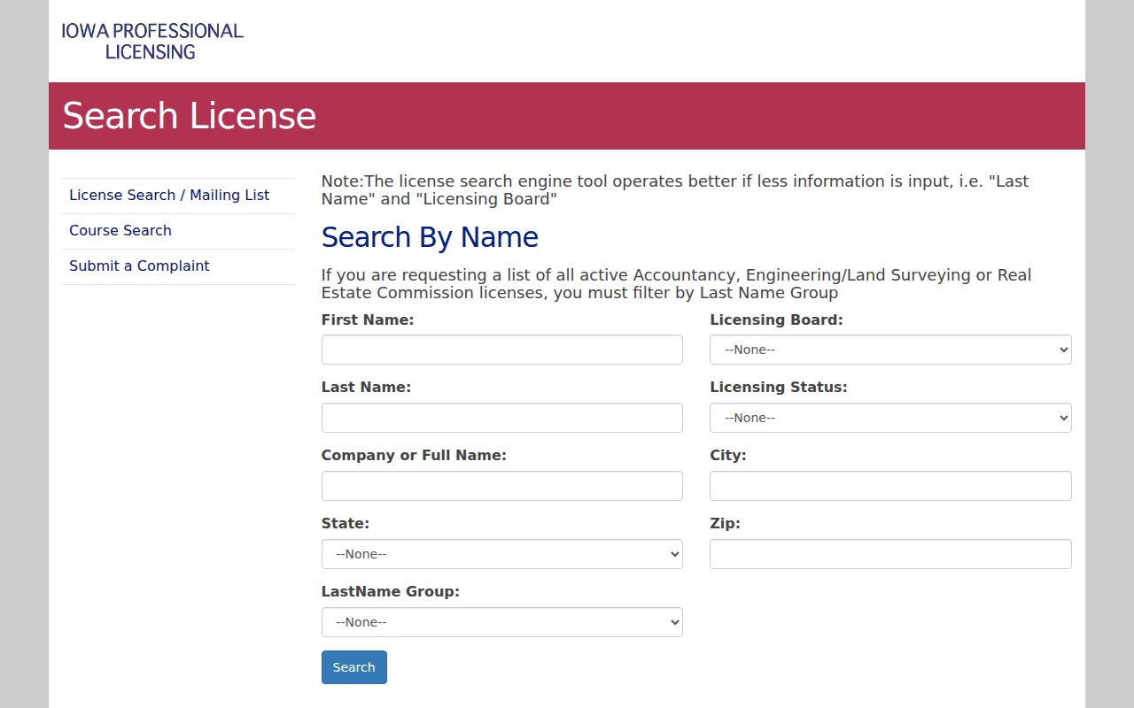
The image confirms that ZIP is one refinement among several. Match the result to a name, board, and license number rather than relying on the Marshalltown location alone.
Marshalltown ZIP Business Results
The Iowa business entity search can return an entity address and status. It is useful for checking whether a filed organization uses a Marshalltown postal label, but it does not establish that an individual lives there. Search by business name or number, then inspect the entity type and status.
The official result interface provides the right context:
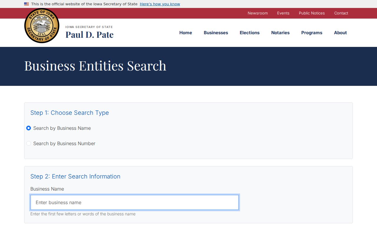
This source belongs in a Marshalltown ZIP code directory only as a filed-location check. A business filing, parcel situs, and postal delivery label may describe the same place in different ways.
ZIP in Marshalltown Voter Records
The Iowa Am I Registered screen uses ZIP with house number and date of birth to distinguish one registrant. That design is an important limit: it is an identity confirmation tool, not a way to browse Marshalltown residents ZIP by ZIP. Even a successful match confirms registration data, not current physical occupancy.
Marshall County's election hub reported 22,908 registrations in its January 21, 2026 snapshot. That countywide number should not be divided among postal codes without an official file or published breakdown. Iowa Code section 48A.38 governs voter-list access, and public list requests follow a separate paid process. For ordinary personal confirmation, use the self-lookup screen and the Marshall County election hub for precinct maps and office information.
Note: A ZIP input that helps match one voter does not turn the voter screen into a Marshalltown ZIP resident list.
Map Marshalltown Beyond the ZIP
County GIS is the next check when a delivery label is too broad. The Marshall County GIS office links parcel maps, address resources, and data requests. Its ArcGIS service supplies parcel and road layers, while the city zoning map supplies the municipal outline and zoning districts. Neither source promises a postal boundary layer.
Collect the standardized delivery address, county, parcel or situs address, municipal-limit status, precinct, zoning class, and map coordinates as separate fields. Keep the parcel ID as an opaque join key unless the Assessor explains its parts. The city subdivision rules also reach new subdivisions within two miles of city limits, another reason a planning record should not be read as proof of municipal inclusion.
Marshalltown Associated ZIP Myth
The USPS association of 50126, 50201, and 50247 with the Marshalltown 50158 post-office entry does not mean all three codes are Marshalltown city neighborhoods. It shows a postal relationship in the FAST labeling list. The source does not draw city limits, assign parcels, or state that every address under those codes uses Marshalltown as its legal municipality.
When one of those codes appears, return to the full address. Check USPS for the delivery label, GIS for the parcel, the zoning map for city limits, and elections for the precinct. That four-part check preserves the useful postal clue without turning it into a false geographic claim.
Marshalltown ZIPs Versus City Limits
USPS codes route mail. Marshall County GIS maps parcels and roads. Marshalltown's zoning map shows city limits, historic districts, streets, and land-use districts. The voter system assigns precincts. These layers overlap, but none can replace another. The downtown core along East and West Main, with parts of State, Church, Center, 1st Avenue, 2nd Avenue, and 1st Street, is a precise city map description. It is not a postal ZIP boundary.
- ZIP and ZIP+4
- The five-digit delivery area and the more exact four-digit add-on USPS may assign to a block, building, or delivery group.
- PO-box ZIP
- A code used for post-office boxes rather than a mapped neighborhood. No Marshalltown-specific box-only role was confirmed here.
- Unique ZIP
- A code assigned to one large recipient. No unique Marshalltown code was established in the research.
- Carrier route
- A mail-delivery path within a ZIP. It is not a city boundary or parcel line.