
Walk a Marshalltown Street
A reliable by-street search keeps ownership, location, and occupancy evidence in separate columns. The Marshall County Assessor supplies the current parcel card. County GIS supplies the shape, roads, aerial view, and nearby parcel numbers. Iowa Land Records supplies the recorded chain. Directories and election tools add dated clues, but a hit is not proof that a person lives there today.
- Enter the complete address through the Marshall County Property Search. Save the parcel number, situs address, legal description, owner display, mailing label, and sale rows.
- Open Marshall County GIS. Select the parcel, check its road and subdivision labels, and note each touching parcel without treating approximate map lines as a survey.
- Search the current owner as grantee in Iowa Land Records. Match the document to the legal description, not merely to the street name.
- Check Marshalltown permit reports and a directory edition for dated address events. Record the edition or report month beside every result.
- If the question concerns one named person instead of the full street, move to the resident search workflow and verify the person through a second custodian.
This flow is the core of a Marshalltown street directory search because every later step keeps the parcel as its join key. A name can repeat. A street number can change. The legal lot or parcel record is less likely to merge two unrelated places.
Marshalltown Street Search Fields
The county landing page links both Beacon and wEdge. Their labels and result screens can differ even though Marshall County is the custodian. Start broad, then refine. A starts-with search may succeed where a fully typed street does not.
| Portal field | Input | Best use |
|---|---|---|
| Street address | House number and street | Find the first parcel card |
| Direction and street name | N, S, E, W plus partial name | Separate similar street forms |
| Parcel or property number | Number, often without punctuation | Reopen an exact parcel |
| Owner, buyer, or seller | Name text | Connect card and sale roles |
| Sale date and price | Date range and number | Narrow transfer events |
| Municipality or subdivision | Selected place | Keep results within Marshalltown or one plat |
The result may also show values, building traits, photographs, a sketch, recent sales, and permit rows. Those fields describe the card at its update point. They do not certify the present state of a building or identify every resident.
Two Marshalltown Property Doors
One easy-to-miss Marshalltown quirk is the county page's link to two vendor searches. A researcher may enter through Beacon and later see wEdge fields for the same county source. That does not create two independent records. Cite Marshall County as custodian, note which interface and date were used, and save the exact parcel number.
Insider tip. The assessor distinguishes a parcel's situs from the owner's notice address and does not supply unrelated phone numbers or email addresses.
A situs address is the physical location assigned to the parcel. The mailing address is where tax or assessment notices go. If they differ, do not turn the mailing label into a claim about who occupies either place. This distinction prevents one of the most common errors in a street directory.
Marshalltown Records by Address
No single roll identifies all people along a Marshalltown street. The best result is a dated set of official roles. The table shows how the main address sources fit together and where the web trail gives way to an office or archive request.
| Address source | Keeper | Evidence returned | Access path |
|---|---|---|---|
| Parcel card | Marshall County Assessor | Situs, owner role, mail label, parcel, sales | Beacon or wEdge links |
| Parcel and road map | Marshall County GIS | Parcel shape, roads, aerial, adjacent parcels | GIS site or map service |
| Recorded deed | Marshall County Recorder | Grantor, grantee, date, instrument, legal description | Iowa Land Records or courthouse |
| Building permit report | Marshalltown Building Division | Address, permit type, date, value, applicant role | Monthly 2024 to 2026 reports |
| Historic town lot | State Historical Society holdings | Urban lot names and transfers | Archive or custodian, 1855 to 1902 index |
| Directory or newspaper | Library and collection catalogs | Dated address, name, notice, or event | Edition, microfilm, or digital archive |
The parcel number joins the assessor and GIS views. The legal description joins the parcel to deeds and plats. A street name joins permits and scanned pages, but it is weaker because spelling and numbering can shift.
Map Marshalltown Streets in GIS
The county describes GIS as a layered digital map. Useful layers include parcels, roads, aerial imagery, soils, subdivisions, parcel annotation, and parcel numbers. Click along one street, record each parcel ID, and reopen each card in the assessor search. For a formal boundary issue, use the deed, plat, or a licensed surveyor instead.
The Marshall County GIS source is shown below. It also links printable maps, the 911 Address Request Form, a data request, fees, and contact details.
The county page makes the fallback channels clear: contact GIS at the courthouse for a map or data product when the browser view does not answer the street question.
A second captured source is the GeneralMap ArcGIS service listing.
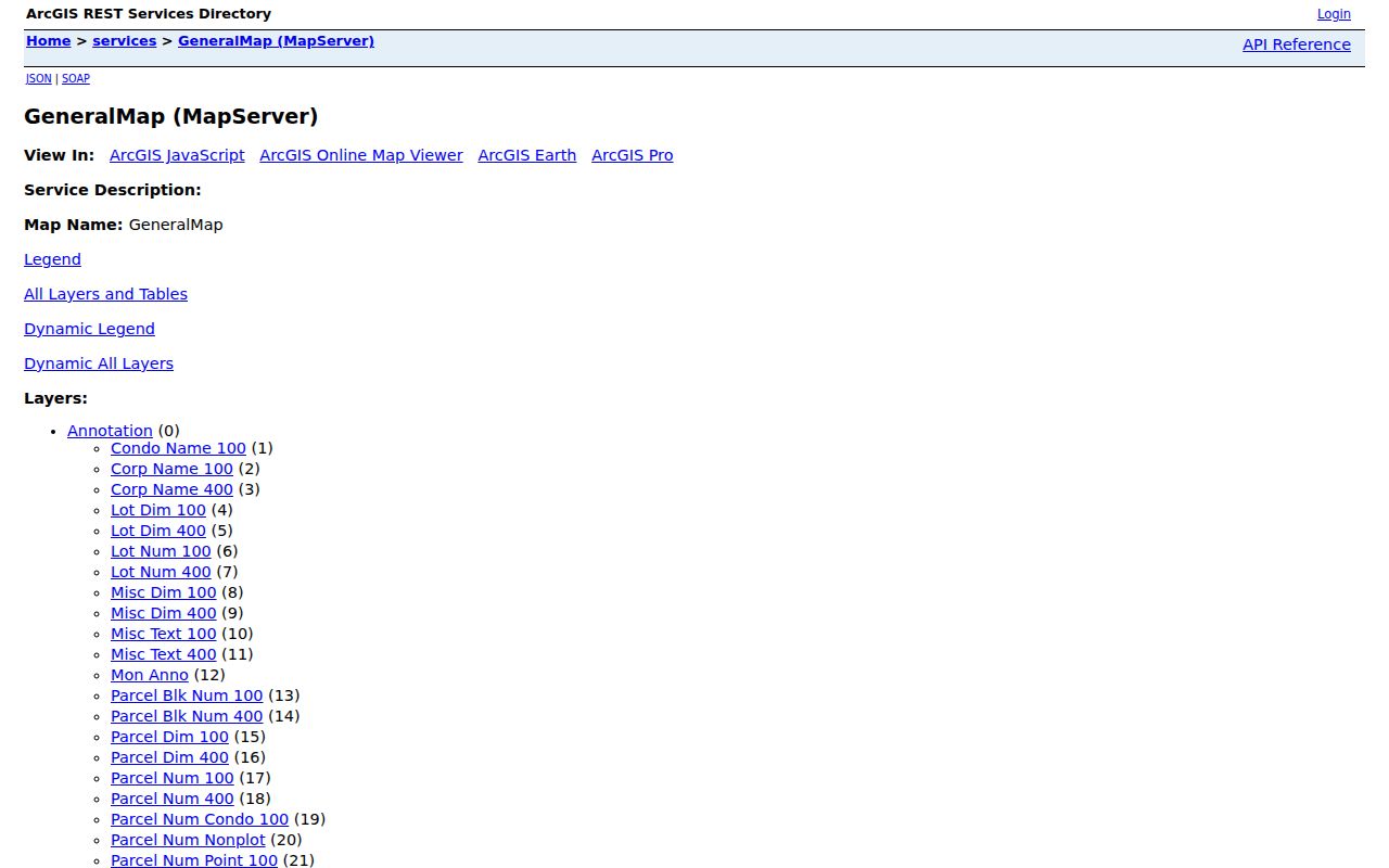
The service listing confirms the county map layers behind a Marshalltown by-address search. It is a technical access point, while the county GIS office remains the custodian.
Marshalltown Street Record Terms
Several short labels carry a lot of weight in an address search. Define them before copying facts from one system to another.
- Parcel
- A mapped unit of land with its own county identifier.
- Situs address
- The physical parcel location, which can differ from an owner's mailing address.
- Plat
- A recorded drawing that lays out lots, blocks, streets, and other legal features.
- Criss-cross directory
- A directory arranged by address or telephone number rather than only by surname.
The research did not locate a confirmed Marshalltown reverse-directory run or a citywide street-renumbering year. Ask the library about a specific edition, and use lot, block, plat, and intersection evidence when an old number fails.
Deeds Along Marshalltown Streets
A deed search turns a current parcel into a chain of named record roles. Begin with the present owner's purchase as grantee, the person receiving an interest. Capture the grantor, recorded date, document type, instrument or book and page, and image status. Then search that grantor as an earlier grantee.
Repeat until the online results stop. If one deed covers several parcels, require a matching legal description. The Marshall County Recorder at 1 E Main Street can help with local records, while Iowa Land Records provides the statewide search. Older urban work moves to the town-lot index and recorded books rather than guessing from a modern street label.
Recording charges are not copy charges. The county publishes a base recording schedule of $5 per page plus a $2 transaction surcharge, but a reader should ask the Recorder for the current charge for a copy or certification.
Iowa Land Records results can be filtered by county, recorded-date range, party role, document type, and whether an image is available. A result may list the document number, recording date, book and page or instrument reference, and separate grantor and grantee names. Capture the role with the name. Searching a surname without its role can reverse the direction of a deed trail. When no image is online, use the index values to ask the Recorder for the exact document. That office also holds contracts, mortgages, assignments, releases, easements, plats, surveys, and liens that can explain why the apparent sale history skips a step.
Marshalltown Permits Mark Events
Marshalltown's Building Division posts monthly building and trade permit reports for 2024 through 2026. Search the address and nearby spellings. A row may give the permit type, date, stated value, and an applicant role. It can date a remodel, repair, demolition, or trade project without naming every person connected to the parcel.
For downtown research, combine permit dates with the official historic-district and zoning maps. The documented core follows East and West Main, with parts of State and Church and short Center Street, 1st Avenue, 2nd Avenue, and 1st Street segments. Those are map limits, not a list of residents.
The zoning map supplies another kind of address context. It labels the urban core, mixed-use areas, commercial and industrial districts, public land, residential districts, recreation land, the historic district, and city limits. A long Marshalltown street can pass through more than one map class. Keep that class in a street log only when it helps locate the parcel or select the right city file. Zoning is not a household trait. Subdivision records can be more useful when a parcel was split or consolidated because the city reviews the plat and the final plat is recorded with the County Recorder.
Older Marshalltown Street Clues
When a street directory search reaches the nineteenth century, the legal lot often survives better than the address. Marshall County historical holdings include town-lot records from 1855 to 1886, a town-lot index through 1902, land deeds from 1850 to 1888, and a general land index from 1851 to 1909. Auditor transfer books and mortgage indexes add more routes.
The Marshalltown Public Library newspaper archive can then search a street with a surname, estate, sale, notice, or permit term. Choose a title and date range so OCR does not blend several decades. Historical city directory editions can add a dated occupant clue; the collection details belong on the Marshalltown city directories page.
Access is not limited to a web page. The Assessor can answer valuation and card questions at the courthouse, GIS can supply data or printed maps, and the Recorder can retrieve an instrument or certified copy. State Historical Society holdings provide the older index roadmap. The library at 105 W Boone Street can confirm current local-history materials by phone at 641-754-5738. When OCR misses an address, try the street without its direction, a short spelling stem, the nearest intersection, and the legal lot from the deed. Save a scan citation before moving on.
Limits of Marshalltown Street Directory
A parcel owner is not always an occupant. A voter confirmation is not a live household list. A directory entry describes its edition date, and a permit applicant may be an owner, contractor, or agent. Driver data, protected addresses, private utility accounts, and other confidential records do not become public merely because an address is known.
Good street-by-street research states what each source actually proves. It also records the date and checks at least two custodians. Safe at Home can shield a participant's address, while map and portal gaps may simply reflect a source's coverage or update cycle.
Lawful use. Use Marshalltown address records for lawful family, property, civic, or safety research, never to track, threaten, or harass a person.